Bank Street
By Phil Cohen —
Bank Street runs from Baird Boulevard and Carman Street southwest, crossing Marlton Pike, and continuing to Admiral Wilson Boulevard, where it ends. When the 1947 city directory was compiled there were only four houses on Bank Street, in the 2500 block. A block of apartments were later built nearby, these were condemned as unfit for human habitation around 1990 and razed a few years later. A few single family homes had also built on Bank Street between Boyd Street and Admiral Wilson Boulevard between 1947 and 1951.
Bank Street acquired a very bad reputation in the late 1980s and all through the 1990s as part of the open-air drug market known as “the Alley,” which centered on the alley one end of which was on Bank Street between Morse and Boyd Streets.
A few new homes now stand on Bank Street, erected as part of the McGuire Gardens redevelopment undertaken by the Housing Authority of the City of Camden and brought to a successful completion under the leadership of Dr. Maria Marquez in the early 2000s.
Maps
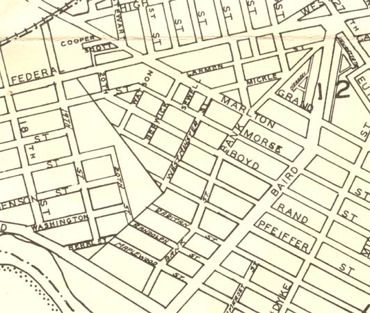
Bank Street — Map published in 1946
2200, 2300, 2400 Blocks of Bank Street
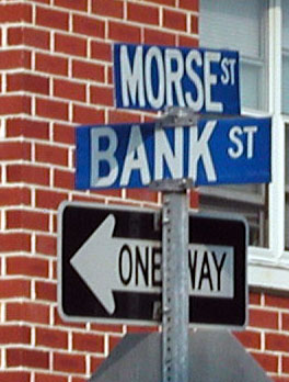
Morse & Bank Streets
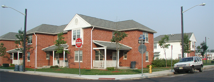
191 Morse Street — Southwest Corner, Morse & Bank Streets, July 2004
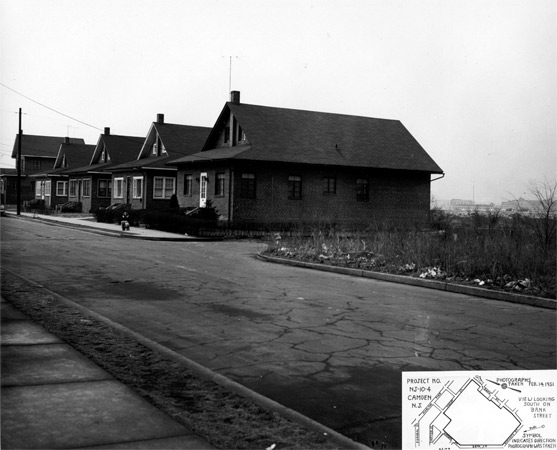
Looking South on Bank Street from alongside 201 Morse Street — February 14, 1951
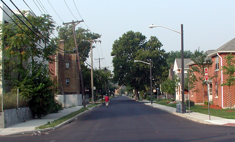
Looking South on Bank Street from Morse Street — July 2004
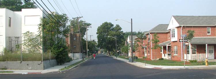
Looking South on Bank Street from Morse Street — July 2004
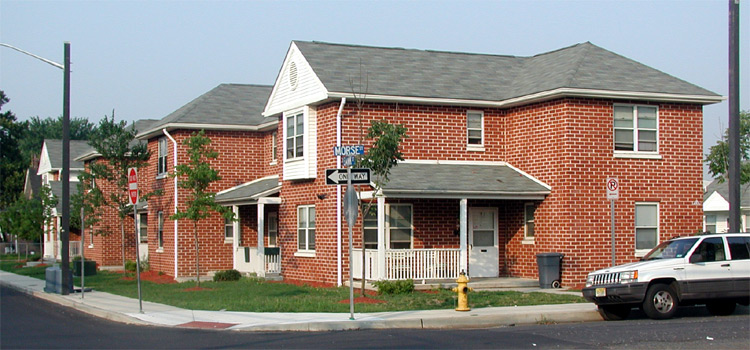
191 Morse Street — Morse & Bank Streets, July 2004
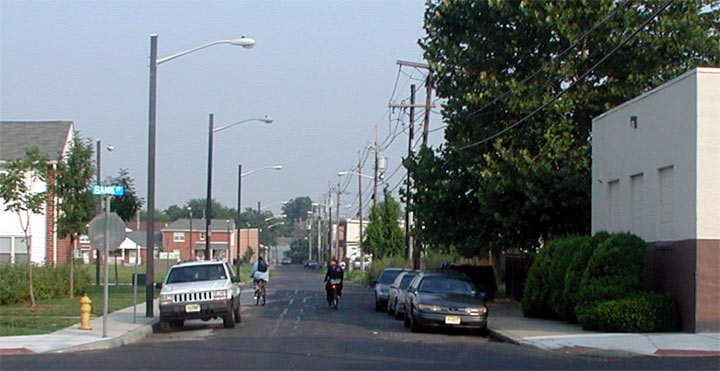
Looking West on Morse Street from Bank Street — July 2004
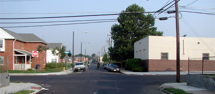
Looking West on Morse Street from Bank Street — July 2004
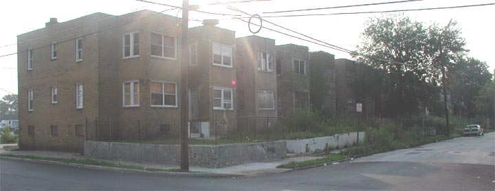
Northeast Corner, Morse & Bank Street — July 2004
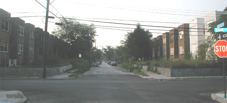
Looking East on Morse Street from Bank Street — July 2004
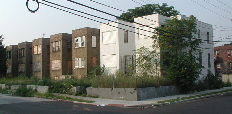
Southeast Corner, Morse & Bank Street — July 2004
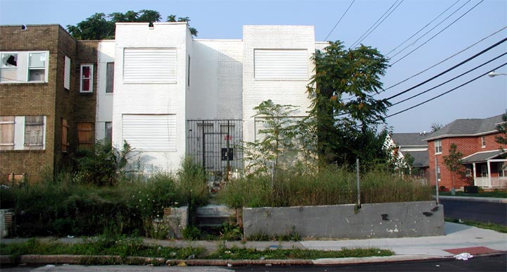
Southeast Corner, Morse & Bank Street (203 & 201 Morse Street) — July 2004
2200 Block of Bank Street
Peter J. McGuire Gardens — address records from city directories.
2257 Bank Street
| Year ↕ | Name ↕ |
|---|---|
| 1950s–1970s | Nicholas Manzi |
Plat Showing Proposed Site, Project No. N.J.-10-4, Camden, N. J.
Plat —
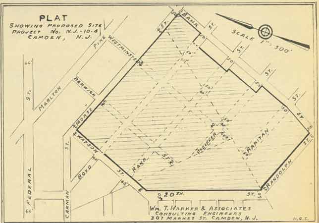
SCALE 1″ = 300′
[street names lettered along the streets on the plat:] Bank St.; Westminster; Pike; Marlton; Berwick; Morse; Watson St.; Boyd; Carman St.; Federal St.; Rand; Pfeiffer Ave.; Raritan; 20th St.; Randolph St.
Wm. T. Harker & Associates. Consulting Engineers. 307 Market St. Camden, N. J. [initials at the lower right:] H.R.S.
2500 Block of Bank Street
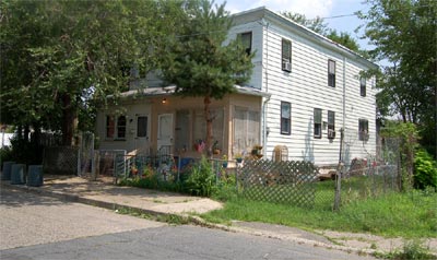
2526 & 2524 Bank Street — July 31, 2006
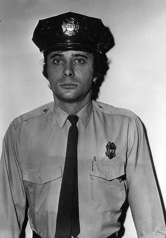
Louis F. Fattore — 2540 Bank Street
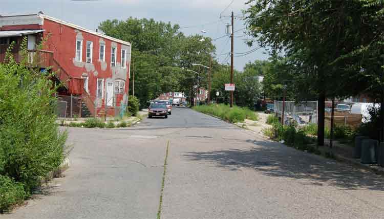
Looking North on Bank Street from in front of 2524 Bank Street — July 31, 2006
2500 Block of Bank Street
Address and occupant records from city directories, 1940–1965.
2524 Bank Street
| Year ↕ | Name ↕ |
|---|---|
| 1940 | Joseph Miller |
| 1947 | Gustav Wirth |
2526 Bank Street
| Year ↕ | Name ↕ |
|---|---|
| 1940 | James A. Price |
| 1947 | Mrs. Mary Bisanti |
2530 Bank Street
| Year ↕ | Name ↕ |
|---|---|
| 1940 | Peter Caughey |
| 1947 | George F. MacKenzie |
2532 Bank Street
| Year ↕ | Name ↕ |
|---|---|
| 1940–1965 | Thomas J. Carr Sr. & Family — Camden Police Department |
2540 Bank Street
| Year ↕ | Name ↕ |
|---|---|
| Louis F. Fattore |
2600 Block of Bank Street
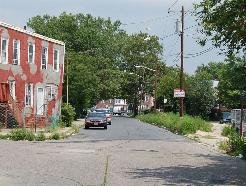
Looking North on Bank Street from South 26th Street & Bank Street — July 31, 2006
2600 Block of Bank Street
Address and occupant records from city directories, 1967.
2607 Bank Street
| Year ↕ | Name ↕ |
|---|---|
| 1967 | Mrs. Mary Huhn |
Authority Acquires 1st Parcel Toward Housing Project
Camden Courier-Post —
Courier-Post Photo
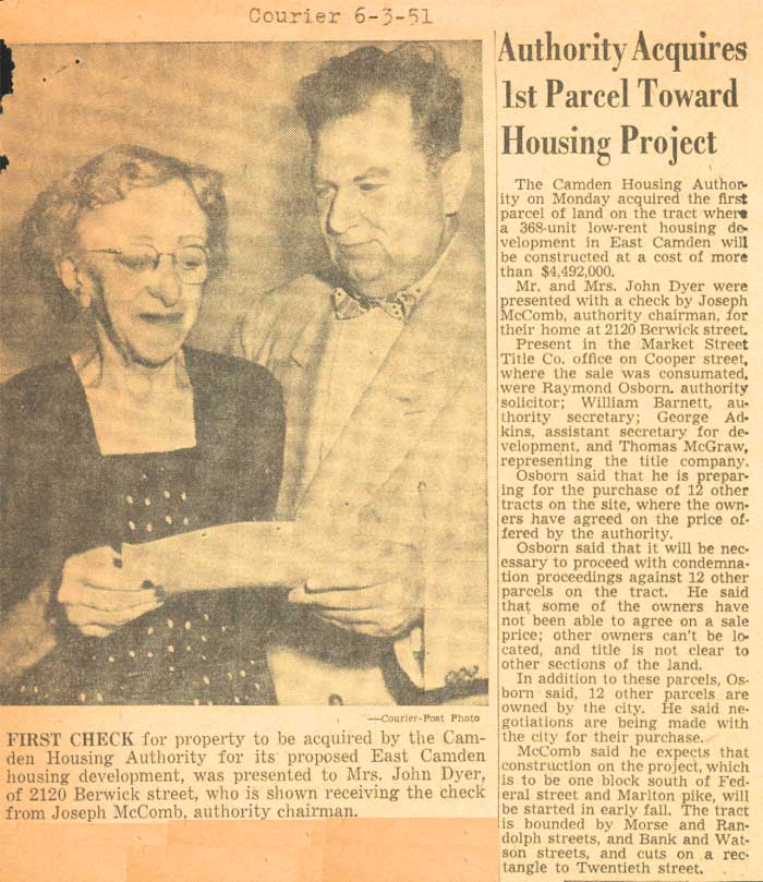
FIRST CHECK for property to be acquired by the Camden Housing Authority for its proposed East Camden housing development, was presented to Mrs. John Dyer, of 2120 Berwick street, who is shown receiving the check from Joseph McComb, authority chairman.
The Camden Housing Authority on Monday acquired the first parcel of land on the tract where a 368-unit low-rent housing development in East Camden will be constructed at a cost of more than $4,492,000.
Mr. and Mrs. John Dyer were presented with a check by Joseph McComb, authority chairman, for their home at 2120 Berwick street.
Present in the Market Street Title Co. office on Cooper street, where the sale was consumated [sic], were Raymond Osborn, authority solicitor; William Barnett, authority secretary; George Adkins, assistant secretary for development, and Thomas McGraw, representing the title company.
Osborn said that he is preparing for the purchase of 12 other tracts on the site, where the owners have agreed on the price offered by the authority.
Osborn said that it will be necessary to proceed with condemnation proceedings against 12 other parcels on the tract. He said that some of the owners have not been able to agree on a sale price; other owners can’t be located, and title is not clear to other sections of the land.
In addition to these parcels, Osborn said, 12 other parcels are owned by the city. He said negotiations are being made with the city for their purchase.
McComb said he expects that construction on the project, which is to be one block south of Federal street and Marlton pike, will be started in early fall. The tract is bounded by Morse and Randolph streets, and Bank and Watson streets, and cuts on a rectangle to Twentieth street.